

You can find on this page the map of Rome tram. Rome tram is a transit system serving the city of Rome (Italy) with the subway, the urban, suburban & commuter train, the bus or the night bus. The tram network has 6 lines and 192 stations forming a rail network of 24 miles (40 km).
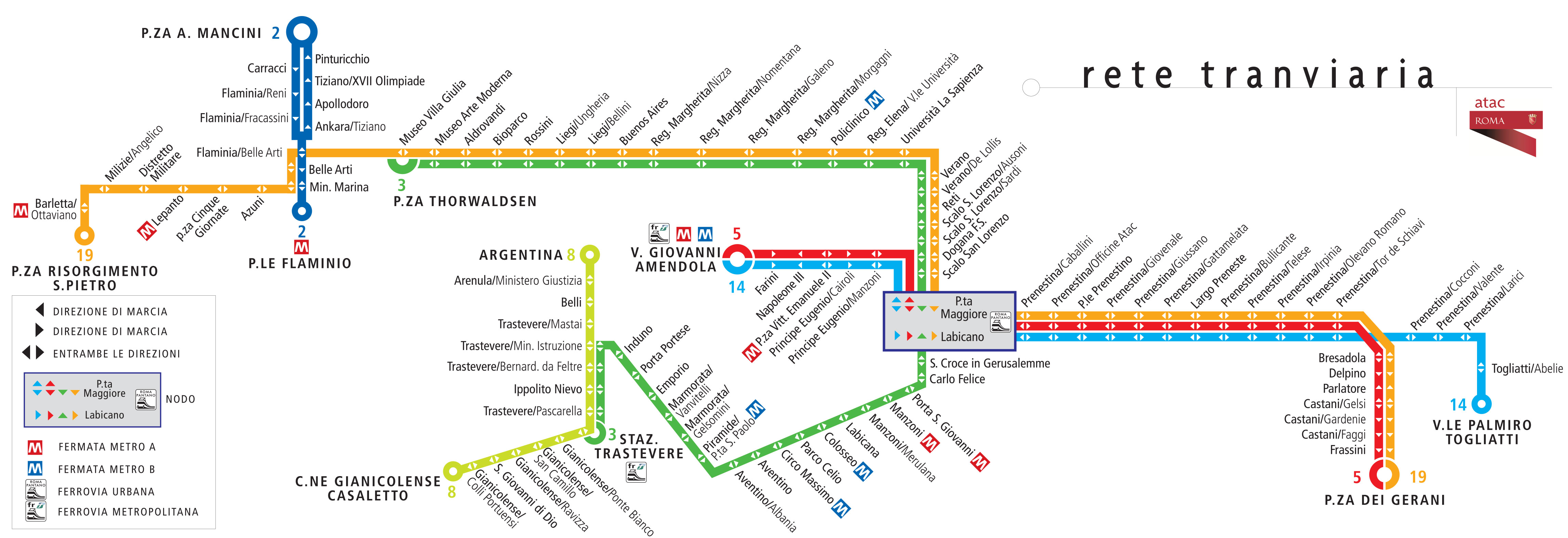
Rome trams exist since 1877 and are operated by the ATAC (Azienda Tramvie ed Autobus del Comune di Roma).
Its network includes the following 6 lines:
• Line 2: Piazza Mancini ↔ Piazzale Flaminio
• Line 3: Piazza Thorvaldsen ↔ Piazzale Ostiense
• Line 5: Stazione Termini ↔ Piazza dei Gerani
• Line 8: Piazza Venezia ↔ Via del Casaletto
• Line 14: Stazione Termini ↔ V.le Palmiro Togliatti
• Line 19: Piazza Risorgimento ↔ Piazza dei Gerani


