

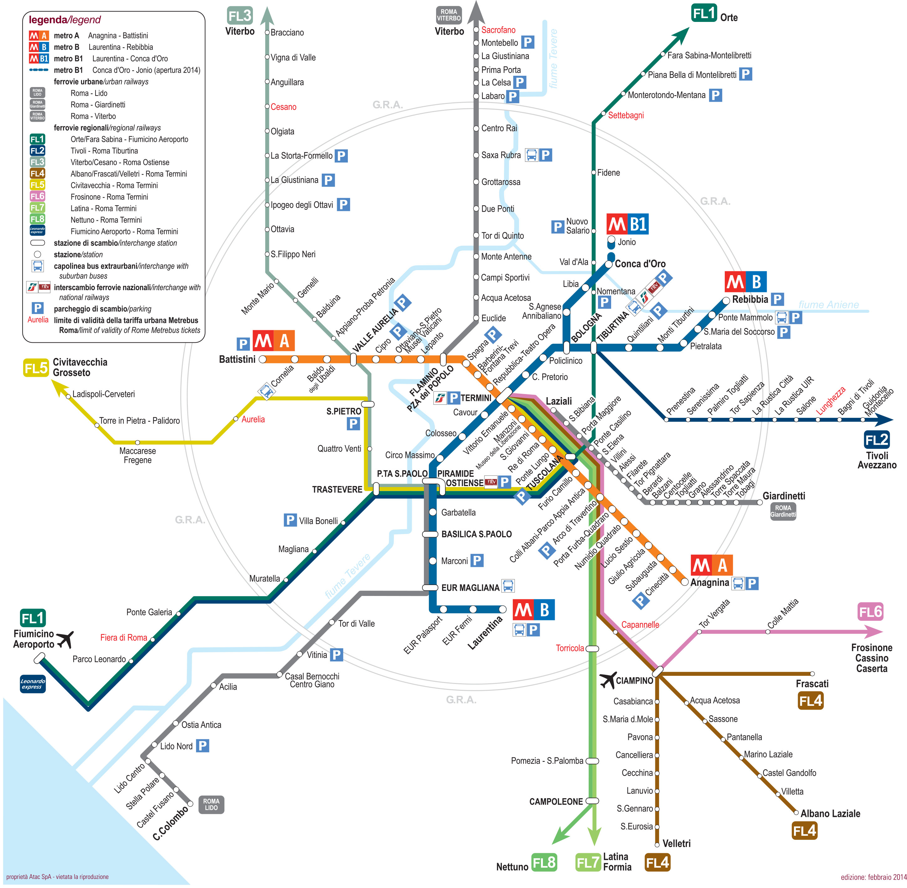
You can find on this page the map of Rome suburban train. The Rome urban, suburban & communter train is a transit system serving the city of Rome (Italy) with the subway, the tram, the bus or the night bus. The commuter train network has 8 lines and 128 stations forming a rail network of 418 miles (672 km) plus 4 rail special lines.
Rome trains exist since 1994 and are operated by the Trenitalia and the ATAC (Azienda Tramvie ed Autobus del Comune di Roma) for 3 special lines.
Its network includes the following 12 lines:
• Line FL1 (Trenitalia): Orte ↔ Fiumicino Aeroporto
• Line FL2 (Trenitalia): Roma Tiburtina ↔ Tivoli
• Line FL3 (Trenitalia): Roma Ostiense ↔ Viterbo Porta Fiorentina
• Line FL4 (Trenitalia): Roma Termini ↔ Frascati / Albano Laziale / Velletri
• Line FL5 (Trenitalia): Roma Termini ↔ Civitavecchia
• Line FL6 (Trenitalia): Roma Termini ↔ Cassino
• Line FL7 (Trenitalia): Roma Termini ↔ Minturno-Scauri
• Line FL8 (Trenitalia): Roma Termini ↔ Nettuno
• Line Leonardo Express: Roma Termini ↔ Fiumicino Aeroporto
• Line Roma Viterbo (ATAC): Piazzale Flaminio ↔Viterbo Viale Trieste
• Line Roma Giardinetti (ATAC): Termini - Laziali ↔Giardinetti
• Line Roma Lido (ATAC): Piramide / Porta San Paolo ↔ Cristoforo Colombo


